|
Simple
set up - just connect your GPS to the serial
port of your computer to see your vessels position on
the chart. |
|
|
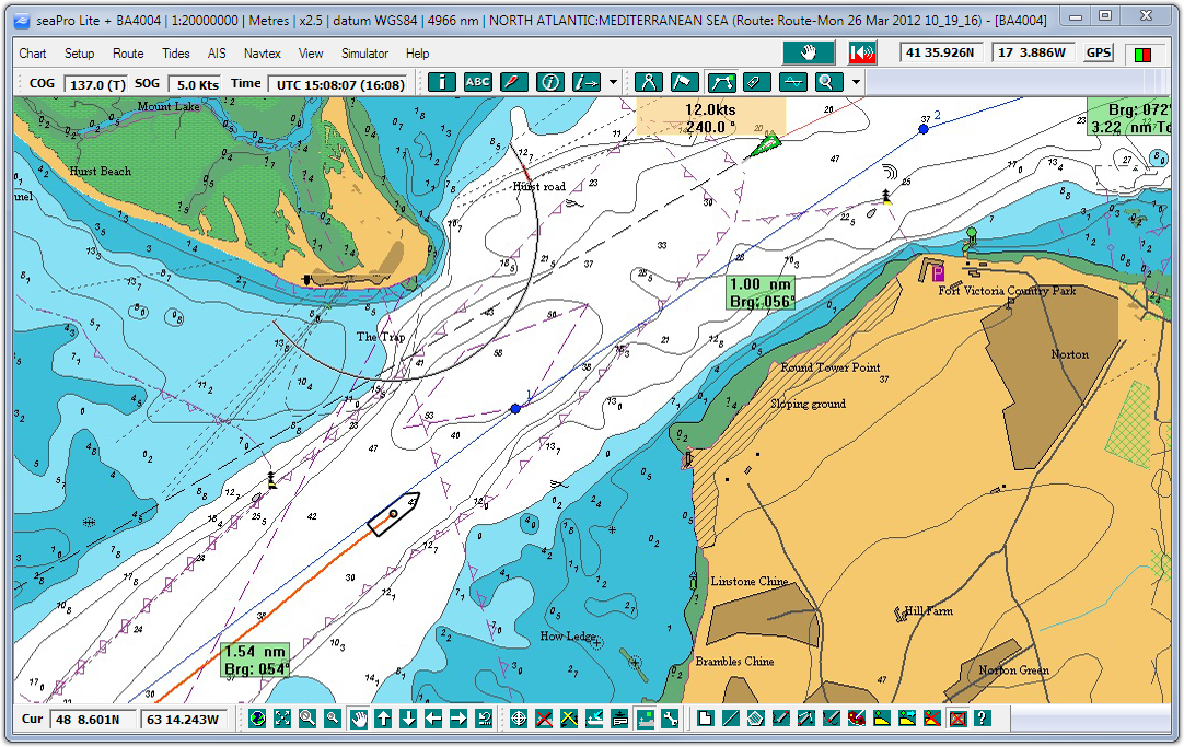
Uses high quality Livechart vector charts
Livecharts are mainly derived directly from S57 data provided from the Hydrographic offices - so no problems of manual digitization from paper charts..
|
|
|
seaPro lite+ support for muliple chart formats
including S57, both encrypted (AVCS, Primar, Australian HO) and unencrypted cells, raster formats such as BSB/BSB4. Seamless changes between the different
formats - allow seaPro lite+ to automatically choose the
best scaled..
|
|
|
Navionics chart option - with this 'add on' use your own Navionics charts (Gold and Platinum) - currently not available |
|
|
Flashing
light sequences (on vector charts as available) |
|
|
Chart zoom & panning tools - move around charts quickly and easily |
|
|
AIS - when connected to an AIS receiver or AIS transponder (class A or B) see information on other AIS equipped vessels (General AIS information). |
|
|
NAVTEX support for the dual frequency NAVTEX receiver gives free Marine weather forecasts and other information. |
|
|
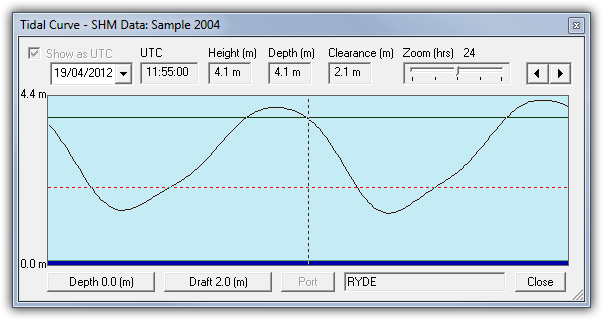
Tidal Curves - view the tidal heights for most of the major and minor ports in the world (requires purchase of optional tidal database). |
|
|
Route Planning
and Monitoring - Position waypoints easily
by clicking the mouse button or edit them manually for
precise positioning. 'On Route' information includes
bearing and distance to next waypoint. All routes can
be saved and re-used as required |
|
|
Autopilot
Control - Once a route has
been created, information can be sent to the NMEA0183
compatible autopilot allowing it to steer to each waypoint
|
|
|
Measure
Tool - Measure distances and bearings quickly |
|
|
Overlay - add your own marks, text, lines,areas for favorite fishing,anchoring or diving sites etc. |
|
|
Extended
Track Line - Shows your boat's position at
30 and 60 minutes based on current speed and course |
|
|
Dockable
Toolbars - Place your toolbars where you need
them, either on the chart or neatly stowed at the top or
bottom of the screen. |
|
|
Folio
Mode - Charts may be selected manually or you
can allow the system to choose the appropriate charts
for you |
|
|
Interfacing - Support for multiple serial ports or GPS/AIS data via a wired/wireless ethernet connection (TCP/IP). |
|