|
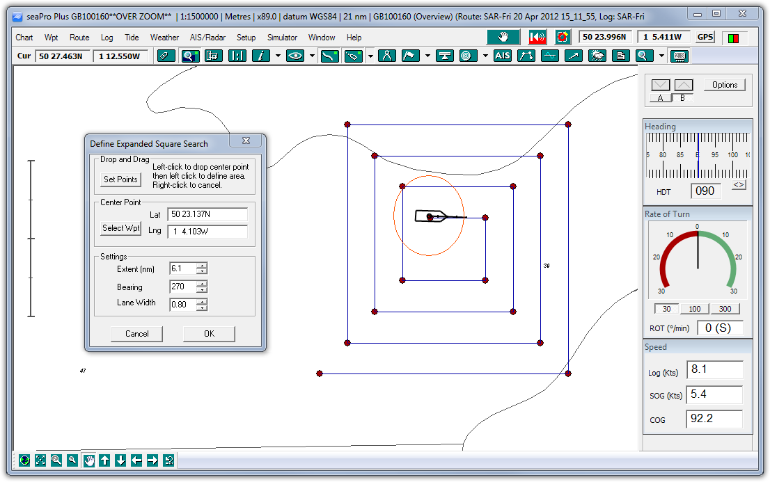
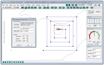
Search & Rescue - Create standard SAR patterns taking tidal information into account. |
|
|
Overzoom
- This feature allows the user to zoom into a chart
beyond the normal viewing level. |
|
|
Multiple
Overlays & Databases - This feature allows
multiple overlays and databases to be displayed simultaneously. |
|
|
Chart
corrections - This function allows you to undertake
your own chart corrections on both vector and raster
charts. |
|
|
Great
circle planning - This makes planning an ocean
passage very simple. Just put a waypoint at the start
and finish of your route and seaPro will fill in the
rest giving you a great circle track. |
|
|
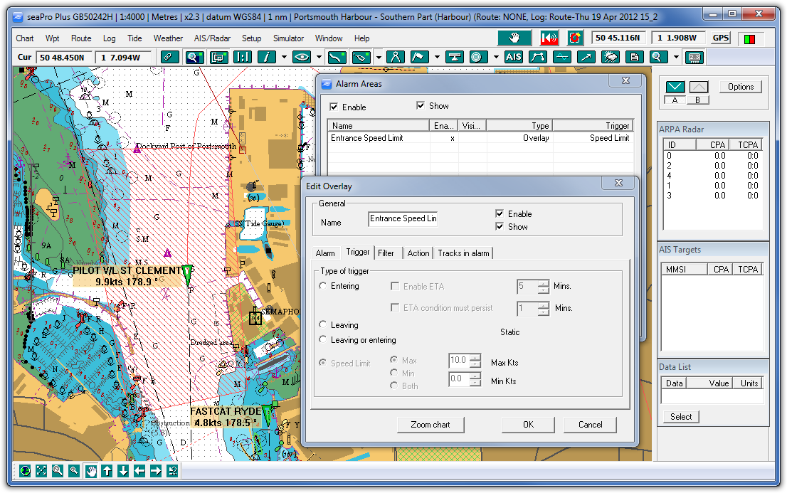
Advanced zone alarms - Set multiple alarm zones using polygon, rectangular or circular areas. Control what triggers the alarm, leaving or entering the alarm zone etc. |
|
|
Enhanced
logging - Any supported incoming instrument
data can be logged. The user can determine the intervals
at which this information is recorded.
|
|
| |
UAIS enhanced features - new target acceptance option and adding of own track id's or comments such as berthing information (port control) etc. to AIS targets  |
|
|
Top 10 Frequently
asked questions
PC requirements
Compare with other products
Download a demo
Download a brochure
|
| |
| |
 |
|
|
Display previous track concurrently with active track - for repeating a known safe navigation passage . |
|
Network
Installation - An additional option for seaPro
Plus, the network installation allows multiple users
to share charts and instrument data |
|
Other
features of seaPro Plus include animated log
replay - own vessel and targets (AIS and ARPA), instrument log graphs, gyro interface and multiple
NMEA interfacing. |
|
Enhanced
overlay facility - ideal for wreck and min-survey
usage |
|
Blank
chart sheets - for very large scale mapping
- ideal for diving, wreck hunting and min-surveys |
|
Act
as a NMEA server, distributing NMEA 183 data
(GPS instruments, ARPA data etc) across a TC/IP network
or across the internet. |
|
Act
as a route server, distributing current route
across a TC/IP networkt. Changes will be updated on
other seaPro plus computers |
|
|
seaPro Plus demostrating on of the advanced Search and Rescue features. Click to enlarge. |
| |
|
| Options |
The above
only touches on what seaPro can do -
download the demo to fully appreciate how navigating with seaPro
can make your time at sea easier and safer.
AIS
Automatic Identification System - Transmit interface
Expand the seaPro interface to a full AIS transponder to allow easy changing of vessel static data and changes to destination, navigation status etc., as well as sending AIS text messages. This option adds to the feature of AIS receive already in seaPro.
|
Navtex
A cheaper and more efficient way to display Navtex information.
Simply purchase a low cost Navtex antenna, then weather
and safety information can be directly received and
displayed in seaPro. |
|
World
wide tidal heights database
Adds a world wide database for most of the worlds primary
and secondary ports |
|
|