Software
- seaPro Lite
- seaPro Standard
- seaPro Performance Sailing
- seaPro Plus
- seaPro Professional
- seaPro Patrol
- seaPro Pilot
- seaPro Fishing
- Platform Protection
- Passenger Information
Charts
Admiralty Digital Products
Hardware
Weather
Charting SDK / API
Mailing list subscription
 |
||
Raster charts / RNCs
Euronav are digital distributors for the Admiralty Raster Chart Service (ARCS).
Quick links
- ARCS coverage
- Pricing (scroll to bottom of list )
seaPro (depending on version) has support for Raster charts including BSB, ARCS using Navigator service (seaPro plus and above) and GeoTiff.
What are Raster charts?
Raster charts are scanned in paper charts which are then georeferenced. Raster charts look identical to paper charts and may sometimes have better coverage than S57 Vector in remote areas,although this difference is rapidly being eroded.
If possible use the vector charts over raster - this is a requirement for ECDIS usage without paper backup.
What are ARCS Navigator licences?
ARCS Navigator is a commercial licence and lasts for 12 months. The licence includes a weekly update service.. Permits are emailed directly to the user and updates can be downloaded from the UKHO web site or sent out on CD (additional cost)
More information and area coverage of CD's here
You can use the Admarility Digital Catalogue to view the required ARCS coverage
Hoe to download and use here
Download the Admirality Digital CatalogNote: For Euronav seaPro products - ARCS Navigator liceince is only supported on seaPro plus and above
Pricing:
Pricing per chart and per area is available on the price list (scroll to bottom)
To purchase ARCS Navigator charts please call sales - phone/email.
Sample screenshot:
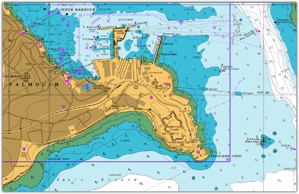
Click to enlarge