#TN064
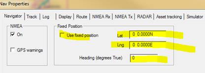
#Summary Radar overlays - not matching the chart The accurate laying of a radar raster image over the chart (or ARPA targets) will depend on a number of factors including 1. The entry of the precise position of the radar antenna location and radar heading (T). Land based systems - seaPro professional check that you have entered the correct location for the radar and have used WGS 84 datum Menu setup->Nav properties
The heading should be the true value, and not the magnetic heading for the direction the radar antenna unit is facing. Mobile platforms 2. The scale of the chart will impinge on the accuracy of the radar overlay. Check that the charts horizontal datum is WGS 84, most modern charts are but in some areas chart datums may be unreliable or unknown (even on up to date charts). Note: This will affect all plotted items and not just the radar - check the plot of your own position against the real position 3. There are inherent inaccuracies in radars, make sure the problems you are seeing are not related to this. i.e. Use a suitable chart zoom and radar range. 4. Check that the installation setup has been fully carried out and user settings are correct. 5. Check that the radar display when viewed in its own window is correct using suitably identified objects. If this is wrong then the chart overlay will also be wrong. Note: Generally you can view the radar overlay image at a lot larger resolution on the chart display compared to the radar window. This is an increase in viewing resolution and not the actual radar resolution or accuracy. Please check your expectations against your radar's specification. Using AIS targets as a test for the radar This is not a recommended method as you are dependent on the AIS information being correct 1. The vessel may have incorrect offsets entered for its AIS GPS antenna which can result in errors 2. The vessel may be a lost target and its position invalid (has a line through it) 3. The position is limited by the accuracy of the GPS being used for the AIS, this can be in error by 100m or more out. 4. You might be looking at a different target on the radar, rather than the AIS target you are comparing against. For example two vessel in line with the radar with the bigger radar target shielding the smaller AIS target. If using AIS targets as a quick check make sure the age of the last report is displayed for the target AIS ->Setup Display option. |
||
|
||
|